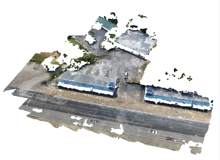
3D Point Cloud

New Shopping Center on 7 South

Drone Used:
TARO 680 -Custom Hexacopter
Camera:
SONY NEX 5n
Job Acreage:
< 1
Missions Flown
1
Images Utlized:
42
Mission Type:
Color Referenced ORTHO Image, Topographic (TOPO) Mapping, DEM/DTM, Dense Point Cloud
Software Used:
Maps Made Easy -Drone Mapping, WebODM -Open Source Mapping, Global Mapper -Drone Image and Mapping tool, QGIS -Open Source GIS Application, Microsoft Image Composite Editor -Image Stitching, Geosetter -GEO Tag Images, RTK LIB -Post Processing Kinematic (PPK)

Image Hosting by Maps Made Easy. Use the menus to zoom and view alternate layers.

Arkansas Drone Services provided, among other deliverable’s, a Dense Point Cloud, ATOKA, inc. a local engineering firm, was then able to save time and therefore money over conventional survey methods on a strip center renovation in the 7 south area of Hot Springs.


Posted

in

,

by

Tags: